
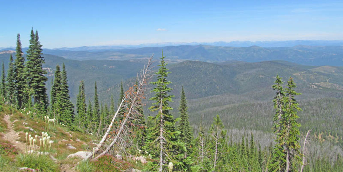
Part of the 360 degree view from Sheep Mountain above Potomac near the lookout.
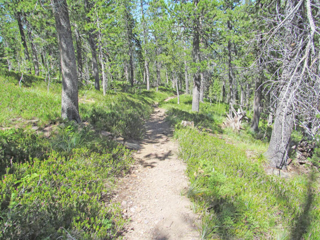
Although starting out fairly flat, the Sheep Mountain trail climbs steadily through forest, rocky points and ridges and is used by mountain bikers, runners, hikers and occasional stock.
Alpine sunflowers growing at an altitude of 7,600 feet on Sheep Mountain July 22, prove to be nutritious for a variety of insects.
Bitter, little non-ripe green, closer pink, pale purple and deep blue made up the huckleberry bushes on Sheep Mountain July 22. The berries were less ripe in elevation than near the trailhead.
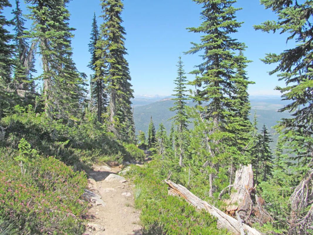
The view looking into the sixth bowl off the Sheep Mountain trail.
The Sheep Mountain trail winds and switchbacks on the side of the mountain with views of the Mission Mountains in the distance, still snow covered.
Directions: Turn north off Highway 200 East onto Gold Creek Road No. 126 near Potomac. Take next left up unmarked Twin Creek Road No. 2117. Stay on main road until trailhead. Total time to trailhead parking is one hour by truck and one hour, 20 minutes with a horse trailer.
To access trail No. 505, go past the trailhead to the right and left up the small rocky slope where trail 505 begins. This is also the trail to the junction of trail No. 513 to Shoofly Meadows. From this trail sign it is five miles to Sheep Mountain, six to Shoofly Meadows and seven to Rattlesnake Creek. About a three hour hike for a family of four and one dog to the summit of Sheep Mountain.
Overview: Leaving the trailhead hike up through huckleberry brush until hitting the trail. Left takes you back to the trailhead and right takes you onward to the junction. This junction trail No. 513 will take you to Shoofly Meadows near Mineral Mountain where you can also join onto the trail to Rattlesnake Creek. Left will take you to Sheep Mountain, elevation 7,650 feet.
The trail begins at once to climb moderately through the forest over Potomac. At the base of the ridge between the fifth and sixth bowls the trail begins the rocky switchbacks upward. Right below the old stone heliport lookout the trail narrows. The heliport grants a 360 degree view of Potomac Valley, Lolo Peak, Mineral Mountain, Boulder Point, the Mission Range, Rattlesnake Wilderness and the Seeley Lake side of the Bob Marshall Wilderness. Here the trail follows the ridgeline up, down and up again between the bowls. The trail is mainly utilized by runners, hikers, backcountry horseman and mountain bikers. The trail is a popular mountain bike route beginning at Woods Gulch near the Rattlesnake Trailhead out of Missoula.
Hot and breezy this time of year there was no snow left on the peak where ladybugs prove the 'swarming phenomenon'. Old telegraph wires from the heliport on the top of Sheep Mountain lead the way toward Missoula by way of Blue Point and Woody Mountain.
Flora and Fauna: Flora brings views of beargrass covered sunny slopes, alpine sunflowers, yellow buckwheat and in the shade, pink wintergreen. Huckleberries were ripe closer to the trailhead with varying degrees of color as elevation increased and were still green near the top.
Fauna includes bears, butterflies, black-tailed deer, mountain lions, elk, cottontail rabbits and grouse.
No water is available save for a pothole in the bottom on the sixth bowl which is hardly accessible.
At A Glance
Length: More than 12 miles from the Sheep Mountain Trailhead in its entirety to the to the Woods Gulch Trailhead past Blue Point on trail No. 513
Elevation: Trailhead: Approximately 5,800 feet; Summit of Sheep Mountain: 7,650 feet
Usage: Runners, mountain bikers, hikers and occasional stock. Loop trail not completely cleared of blowdown.
Services: Limited trailhead parking 10 miles from Highway 200.


Reader Comments(0)