
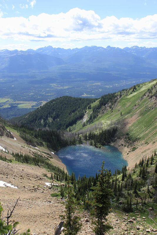
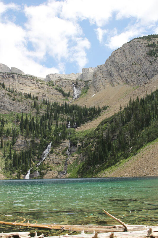
Looking down Upper Rumble Creek Lake at the outlet, hikers can see the Mission Mountains in the distance. The water from the outlet cascades down a sheer cliff dropping 900 feet into Lower Rumble Creek Lake. This photo was taken July 25, 2014. The upper lake still had large ice chunks floating around.
The view of Lower Rumble Creek Lake, the Swan Valley and Mission Mountains from the top of the falls cascading from the outlet of Upper Rumble Creek Lake.
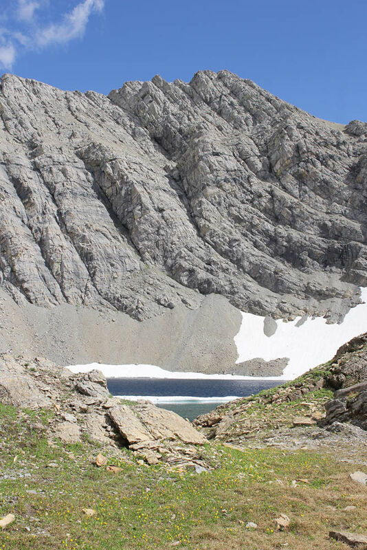
Upper Rumble Creek Lake nestled at the base of Holland Peak. The peak is just to the left, outside of the photo.
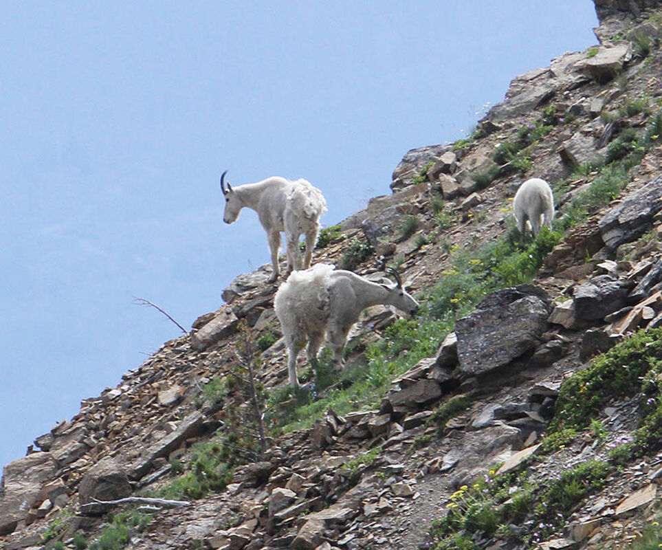
Mountain goats maintain the trails around Rumble Creek Lakes. These three were apart of a larger herd of 10.
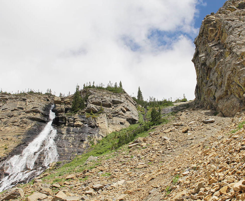
The steep, rocky, treacherous climb along the south side of the falls coming out of Upper Rumble Creek Lake.
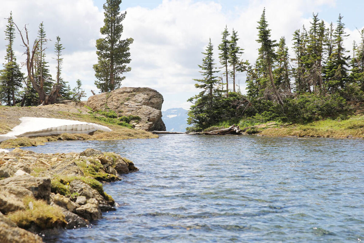
After climbing more than 2,000 feet in a little more than two miles, hikers can enjoy fishing and camping at Lower Rumble Creek Lake. The falls start at the outlet of Upper Rumble Creek, another 900 feet of climb.
Length: 2 to 3 miles to Lower Rumble Creek Lake and another 1/2 mile to a mile to Upper Rumble Creek Lake. Distance varies with route.
Elevation: Trailhead at 4,800 feet; Lower Rumble Creek Lake - 7,000 feet; Upper Rumble Creek Lake - 7,900 feet; Holland Peak - 9,356 feet
Directions to the Trailhead for East Foothills Trail No. 192: Approximately 28 miles north of Seeley Lake or two miles south of Condon, at mile marker 39, turn east on the Rumble Creek Road across from Condon Community Church. Follow Rumble Creek Road 3.7 miles to parking area, which is a quarter mile past Cooney Lookout.
Overview: From the parking area take the East Foothills Trail No. 192 (which is clearly signed). Hikers will turn right at an obvious junction marked with a metal X on a Douglas fir.
After crossing two bridges in short succession, in the Rumble Creek drainage, hikers will come to an unmarked junction. Trail No. 192 continues ahead but the route to Lower Rumble Creek Lake takes off up the hill. The trail is no longer maintained from this point on.
The trail immediately begins climbing and climbing. Flat spots to break and enjoy the ever-increasing view of the Mission Mountains to the west and the Swan Valley below are rare.
After gaining 2,000 feet elevation in just under a mile, the trail begins to sidehill at 6,811 feet dropping a few hundred feet.
On this decline, hikers will encounter a treacherous rocky chute that has turned into a rummage sale of lost items along the slope. A new trail has been established below this section starting in the trees before the chute. This area has been the source of one call to Seeley-Swan Search and Rescue this year.
Hikers then travel through the old Holland Peak Fire of 2006. The fire started by lightning and burned more than 300 acres up to Lower Rumble Lake at just over 7,000 feet.
There are a few different options to hike into Upper Rumble Creek Lake, another 900 feet of gain in around a half mile. The trail follows along the south shore of Lower Rumble Creek Lake into the rock scree and continues to quickly climb. Hikers can follow the trail that continues on a treacherous path of loose rock and scree. At places the trail is hardly distinguishable.
Or hikers can cross the creek below the upper falls and travel cross-country through a more vegetated drainage with no trail on the north side of the creek. Then they will climb a series of low, transverse rock ridges. This approach brings you to the north shore of the upper lake, adding distance for security but does require hikers to cross country with no trail.
Upper Rumble Creek Lake, at 7, 960 feet elevation, is on top of the bench that creates a waterfall at its outlet. It sits at the base of Holland Peak.
Holland Peak is the highest peak in Swan Range as well as the highest summit in the western part of the Bob Marshall Wilderness at 9,356 feet.
Hikers in good condition are known to make the round trip from the trailhead to the summit and back as a day hike.


Reader Comments(0)