
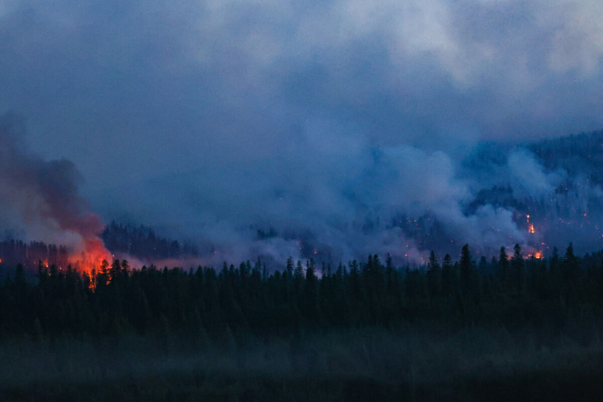
The Colt Fire at around 10 p.m. Friday night. The blaze has grown to approximately 600 acres
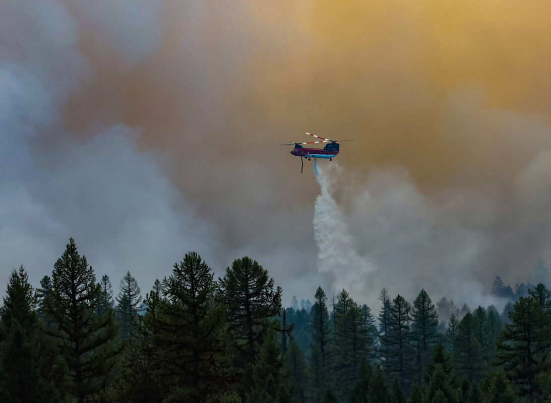
A helicopter roars around a group of torching trees. Several aircraft attacked the fire during the day.
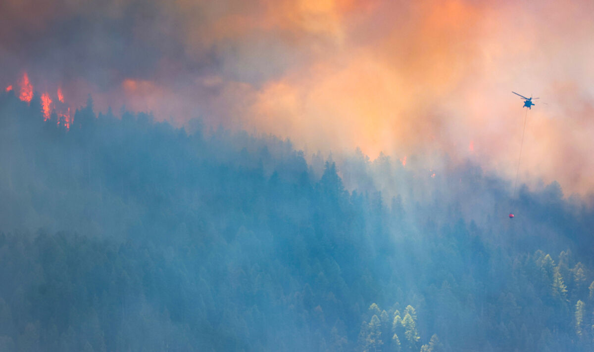
A Chinook helicopter drops a load of water to slow the speed of a burning wall of fire headed towards Lake Alva. Campers at Lake Alva said the campgrounds will be evacuated tomorrow.
Bruce Johnson swims in Lake Alva as firefighters work to hold back the Colt Lake fire. Johnson, from Arizona, joined his friends Denise and Craig Gresham for a four day camping trip in the Clearwater Valley. The trip will be cut short, however, as the trip will likely be evacuated by tomorrow.
(Update: 7 a.m. July 24)
Infrared scans of the Colt Fire showed the burn at 2,927 acres late Sunday night, with much of the new growth burning to the south. The fire still stands at 0% containment, and could make large gains on Monday as critical fire weather enters the area.
The fire has started to approach the West Fork of the Clearwater River near Lake Alva, and Colt Creek Road. Fire managers said in an update on Sunday that crews are building a fire line on Colt Creek Road and Beaver Lake Road.
Other crews are doing structure protection in the Summit Park community. Weather conditions will be poor for firefighting, as a Red Flag Warning has been issued by the National Weather Service from 2 p.m. till midnight on Monday
There is still an evacuation order for those between Mile Markers 27 and 31 on Highway 83.
Those under an evacuation warning include the west and south sides of Lake Inez and mile markers 25.5 to 27 on Highway 83. Rainy Lake, Lake Alva and Lake Inez campgrounds are closed.
A Type One Complex Incident Management Team took over the fire on Sunday, and reported more than 400 personnel. The team has ordered several aircraft to slow the fire.
(Update: 5 p.m. July 22)
The Missoula County Sheriff's Office announced there is an evacuation warning for all residences on the west side of Lake Inez, specifically Beargrass Lane and West Lake Way. Residences between Highway 83 mile marker 25.5 and 27 are also under an evacuation warning.
(Update: 10 a.m. July 22)
The Colt fire is now estimated between 1,000 and 1,400 acres, according to the DNRC and an online interagency dispatch.
A Complex Incident Management Team will be in-briefed today to assume command of the fire Sunday, July 23. Fire crews are building a fuel break on Colt Road on Saturday to halt the flames from reaching Lake Alva, which is less than two miles away from the fire, according to satellite imagery.
The fire has so far cost more than $1 million, according to the Hot Shot Wake Up Podcast.
Fire managers reported there was a drone in firefighting airspace on Friday. It is now a criminal misdemeanor in Montana to fly drones that interfere with fire suppression efforts, according to a press release.
Someone who breaks this law could get a fine up to $1,500 and the potential to be charged with firefighting costs.
(Update: 9 p.m. July 21)
Evacuation orders have been made in areas around the Colt Fire, which is continuing to grow larger in all directions.
The Colt Fire is estimated to be 600 acres as of 9 p.m. Friday and could grow more overnight. The fire is 0% contained and there are currently structures threatened.
Missoula County Sheriff's Office has ordered an evacuation for anyone between mile markers 27 to 31 on Highway 83. The Forest Service has also evacuated Rainy Lake Campground and plans to empty the Lake Alva campground Saturday morning. There is a Red Cross shelter for those displaced at Blackfoot Community Bible Church in Ovando.
There is an evacuation warning for people within mile marker 25.5 to mile marker 27.
The Colt Fire went from 15 acres Wednesday morning to the largest in Montana Friday night, burning heavy fuels and encroaching into private land. The strike was started by lightning on Monday.
The fire is currently 15 miles from Seeley, and less than 5 miles from Lake Alva. The Montana Department of Natural Resources and Conservation is leading the efforts against the fire, with the Forest Service in support.
The fire is burning very intensely, with group tree torching and large spot fires. Fire managers said the fire is consuming fuels fast, with large spot fires sparking ahead of main thermal columns.
Ground crews performed structure protection on the northeast side of the fire on Friday, according to an update later in the evening. Several aircraft worked to slow the spread of the burn in other locations.
In total, four scooper planes, one very large air tanker, multiple large air tankers, two type one helicopters and at least one chinook helicopter took punches at the fire. On the ground, there is one hotshot crew, two hand crews and two engines on the ground fighting the fire.
The DNRC said more resources are on the way.
Further evacuations could be in place as the fire grows. Evacuations will likely first be seen on the Missoula County Sheriff's Facebook page. Fire managers also recommended signing up for emergency alerts on smart911.com. The most accurate fire updates will likely come from inciweb.com, an interagency fire dashboard.
While Highway 83 is still open, officials ask the public to not stop on the side of the Highway where fire activities are taking place.
Starting Saturday morning, a type one incident team will begin taking over the fire. The crew hopes to keep using aerial tools to combat the blaze, which will likely be active on Saturday.
The weather is expected to reach 90 degrees in the area, with humidity down to 14% during the day. The low Friday night is also expected to stay in the high 50s.


Reader Comments(0)