
A Place for All - Part I
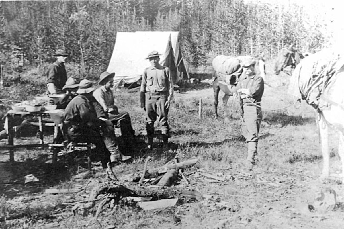
Woodward Camp, Thomas Cooney on right, 1907.
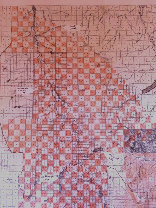
1917 Flathead National Forest map from the Summit to Goat Creek. Northern Pacific lands are shaded in red.
Many people are not aware that the Northern Pacific Railway Company (NP) had a significant influence on the settlement, economy and timber industry of the upper Swan Valley.
Looking at a current map of the upper Swan Valley, you might ask, "What influence?" No railways are located in the valley, nor are any Northern Pacific properties listed on the current maps.
A closer look at the early history of the settlement in the upper Swan Valley reveals something quite different. Maps of the early 1900s show the upper Swan Valley in checkerboard ownership comprised primarily of alternating sections (one square mile) of US Forest Service (USFS) and NP lands.
The checkerboard pattern came about in 1864 when President Lincoln signed a law authorizing the NP to build a railroad and telegraph line from Lake Superior in the Midwest to Puget Sound along the Pacific coast. As an incentive to help fund the project, the act stipulated that NP be given alternating sections of public land for 40 miles on each side of the "road" through the various territories (including Montana) and 20 miles of public land through the states. But there were exceptions to the massive land transfer. No land could be taken from Indian reservations, private lands already taken within the corridor and some lands with certain mineral wealth. However, any of these lands excluded would be compensated for "In Lieu" lands elsewhere.
That is how the NP came to own alternating sections in the Swan Valley, the Mission Mountains, and part of the South Fork in the present-day Bob Marshall Wilderness. Despite controversy about the tremendous size of the project, the largest land grant in US history was completed. NP was given approximately 13 million acres of land in Montana, becoming the state's largest landowner.
Through a series of starts, stops and challenges, the NP line was finally completed across the northern tier of the U.S. in 1883. The NP obtained more than 39,000,000 acres for their efforts. To help pay the cost of building and maintaining the railroad line, NP sold some of the newly acquired lands, as well as the timber. Through the years some of these lands were either sold or traded to the USFS or other government agencies.
In the early 1900s, much of the upper Swan Valley had yet to be surveyed. Locating the boundary line between USFS and NP lands was a difficult task. One early-day settler by the name of Simmons squatted on land near the present-day Swan Peak pullout intending to homestead on what he thought was USFS land.
The Forest Homestead Act of 1906 stipulated that only USFS lands could be homesteaded. When Simmons learned that his cabin and barn were on NP land, he moved on. He was either unwilling or unable to buy the NP land. The meadow where his cabin was located is known locally as Simmons Meadow. Because he was 'squeezed' off his land, the creek nearby became known as Squeezer Creek.
In 1907, the USFS sent a crew of 23 men led by forester Karl Woodward to begin a survey and inventory of the timber resources in the Swan River and Clearwater River drainages. The survey crew plotted section lines and created maps that later the General Land Office (GLO) used to legally allocate land for homestead claims and railroad sections. One of the crew members, Thomas Cooney was a land agent representing Northern Pacific. The NP company paid part of the expense of the survey to gather information about its grant lands.
A number of the survey crew members bestowed their names on some of the natural features of the area. Woodward Lake in today's Bob Marshall Wilderness, as well as Woodward Creek in Swan Valley, were both named for Karl Woodward. Piper Creek (Bill Piper), Sawyer Creek (G.E. Sawyer), Benedict Creek (Junius Benedict), Groom Creek (Dick Groom), Van Lake and Van Peak (Orrin D. Vandarwarka), were all named for crew members of the survey party.
It is speculated that Cooney Creek was named for the NP representative Thomas Cooney who was a Rough Rider in the Spanish-American War under Theodore Roosevelt.
Crew members Junius Benedict and John B. Taylor both left written accounts of their experiences. In his book "A Job With Room and Board," Taylor wrote about the magnitude of the survey project:
"...we learned that our party was to make a rough map and timber estimate of some half million acres, covering the entire drainage of the Swan River and of the Clearwater River, a tributary of the Big Blackfoot River to the south. We worked in parties of four men each, running lines east and west by compass and pacing and recording by species and diameter the trees on a strip one chain (four rods) wide. Each line started from a mile post established by a survey crew on the main trail and was continued until it reached timberline on either the Mission Range to the west or the Swan Range to the east. The men carried packs containing two blankets for the four men, together with food sufficient, we fondly hoped, to last out the trip. The line went straight through every thicket of willow or devil's club (a thorny bush), through tangles of fallen timber from old fires, across streams and swamps and up rough mountain canyons."
Later that summer, while sitting around a campfire, Taylor and other crew members discussed their survey endeavors. Taylor wrote, "...we all agreed, easterners and westerners alike, that it was rather foolish to map this wilderness and to make a rough cruise of the timber. It could not conceivably be logged in our lifetime, we thought."
Next Week: The story continues about the influence of the Northern Pacific Railroad on the Upper Swan Valley from the early 1900s to present day.


Reader Comments(0)