
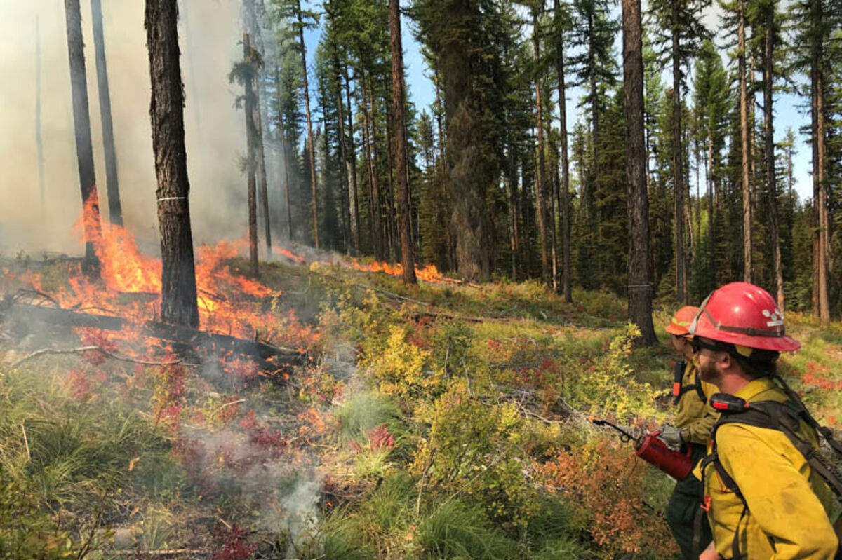
Prescribed burn at Colt Summit in the fall 2018.
SEELEY LAKE - The Seeley Lake Ranger District is planning to conduct prescribed burning and pile burning this fall to help restore habitat and better protect nearby communities from future wildfires by reducing hazardous fuels. Frequent, low-intensity fire is essential to restore National Forest lands for the communities who depend on them. Prescribed fires improve habitat conditions for wildlife by promoting nutrient recycling of fire-adapted vegetation and growth of new forage for wildlife browse. Additionally, prescribed fires help to reduce crown fire potential and eliminate dead and diseased trees to improve overall forest health and resiliency.
Prescribed burns will only be implemented if conditions are favorable. Favorable conditions include correct temperature, wind, fuel moisture and ventilation for smoke. When these criteria are met, firefighters implement, monitor and patrol each burn to ensure it meets forest health and public safety goals including air quality. Prescribed burns will be implemented using a combination of hand and aerial ignition methods.
"We will only initiate burn operations if we can do so safely and effectively," said Quinn Carver, Seeley Lake District Ranger. "In coordination with our partners, we're burning on days that maximize safety and minimize smoke impacts. We're looking big-picture; a little smoke in the fall is a time-tested way to reduce impacts of catastrophic wildfires in the future."
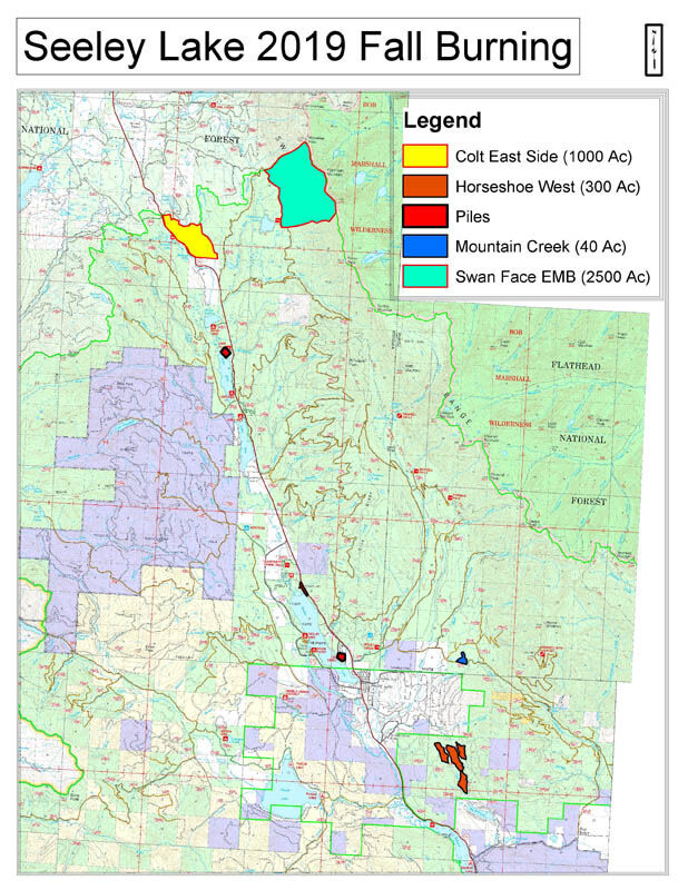
Prescribed Burn Units:
• Horseshoe West Prescribed Burn: located approximately two miles southeast of the community of Seeley Lake; east of Highway 83 between mile markers 10 and 13 (300 acres)
• Colt Summit Prescribed Burn: located east of Highway 83 between mile markers 30 and 33; approximately 15 miles north of Seeley Lake (up to 1,000 acres)
• Swan Face Prescribed Burn: located east of the Clearwater Lake loop; approximately 15 miles north of Seeley Lake (up to 2,500 acres)
• Mountain Creek Prescribed Burn: located along Forest Road 477, three miles east of Highway 83 (50 acres)
• Pile Burning Units: Big Larch Campground; Lake Alva Campground; Seeley Lake Ranger District Office; Logging piles associated with Rice Ridge and Liberty Fire Salvage (various locations throughout the Rice Ridge and Liberty burned areas)
This project will be in compliance with Montana air quality standards and coordinated with Montana State Department of Environmental Quality to reduce the impacts of smoke to our neighbors, cooperators, and surrounding communities. Smoke is expected to be a short-duration event and may settle in valley bottoms and drainages overnight, but is expected to dissipate in the mornings.
For additional information about these projects contact the Seeley Lake Ranger District at 406-677-2233 and follow the Lolo National Forest on Facebook @lolonationalforest or on Twitter at @LoloNF.


Reader Comments(0)