
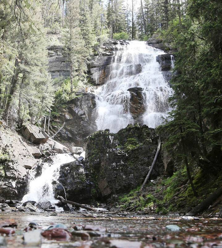
The Upper Falls on Morrell Creek is not frequented nearly as often as lower Morrell Falls. There is an unmarked trail 100 yards before you reach the lower falls that takes you to the upper falls. It is a steep climb and is not maintained; use extra caution.
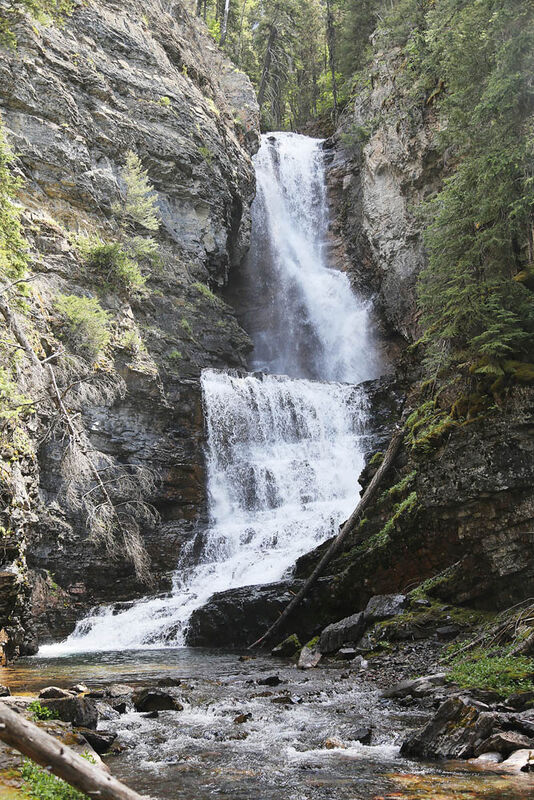
Morrell Falls is a 90-foot drop from the top of the main falls. Photo taken June 25.
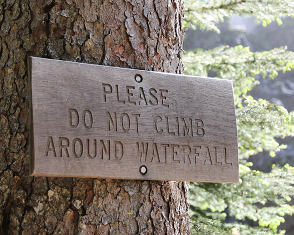
Just a reminder to refrain from rock climbing around the falls.
For a more ambitious hike, continue following the trail past the upper falls. While it stays in the bottom of a deep canyon along Morrell Creek, the view when it opens up in an avalanche chute is breathtaking.
Length: 2.7 miles one way
Elevation: Trailhead: 4,730 feet; Falls: 4,840 feet; Highest Point: 4,880 feet
Usage: Heavy: Hiking, mountain biking and horseback riding allowed. No motorized use except with snowmobile after Dec. 1.
Services: Parking, Vault toilet at trailhead and several dispersed, undeveloped campsites. No developed drinking water.
Directions: Head north on Highway 83 from Seeley Lake 0.5 miles. Turn east (right) onto Morrell Creek Road just north of the Seeley Lake Veterans Memorial Park. Follow Morrell Creek Road for one mile. Turn north (left) on West Morrell Road (Forest Road 4353). Follow the road for nearly six miles. Turn east (right) on Pyramid Pass Road #4381, go .25 miles. Turn north (left) on Morrell Falls Road #4364. Continue for 1 mile to the Morrell Falls Trailhead. The route is well marked.
Overview: This is one of the most popular trails on the Seeley Lake Ranger District. It leads to Morrell Lake and beautiful Morrell Falls at the base of the Swan Mountain Range.
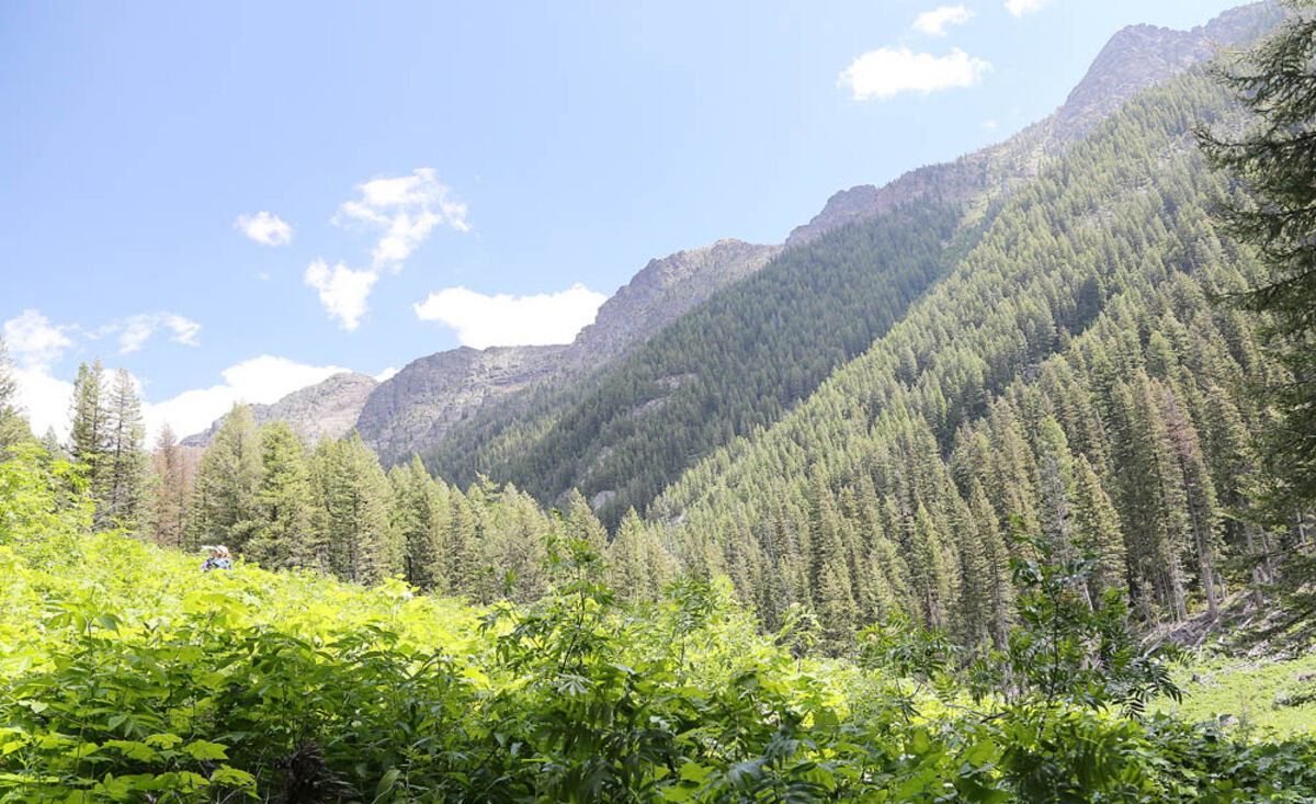
The first portion of the trail is located through a lodgepole pine flat. The remainder passes through a mixed forest of pine, fir, larch and spruce. The drainages in this area support a variety of wildlife including beaver, bobcat, black and grizzly bear, elk, deer, mountain lion and moose.
Morrell Lake is located approximately 2.3 miles from the trailhead. Views of the Swan Mountains are tremendous from the 23-acre lake.
Morrell Falls, located past the northeast corner of the lake, marks the end of the main trail. Morrell Creek cascades down a spectacular 90-foot double falls.
A short, steep climb up a trail 100 yards from the falls provides a rewarding view of the falls from above and leads to the upper falls. Climbing on and around the falls is very dangerous and should be avoided.
Safety & Etiquette: This trail is in grizzly bear country. Visitors are reminded to take appropriate precautions including traveling in groups, carrying bear spray and hanging food or using bear resistant containers.
Hikers botanizing along the lakes should be careful near the edges as the vegetation may be on floating mats.
Raingear and bug spray are recommended.
Visitors are also reminded to practice Leave No Trace, Leave No Weeds and proper trail etiquette techniques.
Associated Trails:
• Grizzly Basin Trail #409: An old hunter/trapper trail that heads six miles north into the Grizzly Basin area. Leaves main trail about 100 yards from the base of the falls and heads into the Swan Mountains along the east fork of Morrell Creek. This trail is unmaintained and can be difficult to follow. It offers solitude and more natural and physical challenges.
• Morrell Creek Trail #383: A primitive trail that takes off from main trail near Morrell Lake. It goes up the west fork of Morrell Creek to Trail 430. Three and half miles long and infrequently maintained.
• Crescent Mountain Trail #391: (Editors note: this trail appears on some maps but may not exist anymore) A primitive trail that takes off from the beginning of the main trail and climbs onto the flank of Crescent Mountain. A mile and a half long and is not maintained.


Reader Comments(0)