Sorted by date Results 1 - 1 of 1

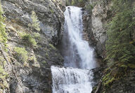
Length: 2.7 miles one way Elevation: Trailhead: 4,730 feet; Falls: 4,840 feet; Highest Point: 4,880 feet Usage: Heavy: Hiking, mountain biking and horseback riding allowed. No motorized use except with snowmobile after Dec. 1. Services: Parking, Vault toilet at trailhead and several dispersed, undeveloped campsites. No developed drinking water. Directions: Head north on Highway 83 from Seeley Lake 0.5 miles. Turn east (right) onto Morrell Creek Road just north of the Seeley Lake Veterans... Full story